


The Wild Horses of Shackleford Banks
Excerpt from The Wild Horses of Shackleford Banks. Text by Carmine Prioli and Photographs by Scott Taylor.
On September 6, 2003, at the height of hurricane season, meteorologists detected a tropical disturbance in the central Atlantic. Within days, the disturbance grew to a de-pression, then to a storm of epic size, the first category five to develop in open water since Hurricane Mitch in 1995. Winds peaked at 160 miles per hour. Storm clouds roiled above 275,000 square miles of seething chaos, an area bigger than the state of Texas. Named Isabel, the hurricane was one of the strongest to menace the East Coast of the United States in recent times. Moving west-northwest, Isabel swelled, then degraded. During the next few days, the storm was demoted to categories four, three, then two. But Isabel was a “strong” category two, and she stayed on course toward North Carolina’s Outer Banks.
Over the years, residents of Carteret County, North Carolina, have become familiar with ferocious storms. Destruction and death were visited upon them by the monster hurricanes of the 19th century, especially the San Ciriaco storm of 1899, which drove scores of ancestral Ca’e Banker families from their Shackleford Banks villages to more secure homes on the mainland. There are descendants of Bankers who still recall the “storm of ’33,” which opened an inlet west of the diamond-patterned Cape Lookout Lighthouse, severing Shackleford from the elbow at the cape. Many others own vivid memories and worn snapshots of the aftermaths of Hurricanes Carol, Hazel, Donna, and others from the 1950s and 1960s and more recent heavyweights like Hugo, Fran, and Floyd from the1980s and 1990s. The toll these storms have taken in human life and property damage is beyond reckoning. Animal populations have suffered as well.
Prior to the 1930s, when they were removed to preserve the islands’ vegetation and, later, to make way for land development, free-roaming livestock—cattle, sheep, goats, pigs, and horses—were common everywhere on the Outer Banks. When the big storms arrived, these animals stood unshielded against tempests and tidal surges. Thousands perished in what older Bankers called “sheep storms.” Their drowned carcasses washed up on the mainland shoreline, often many miles away.
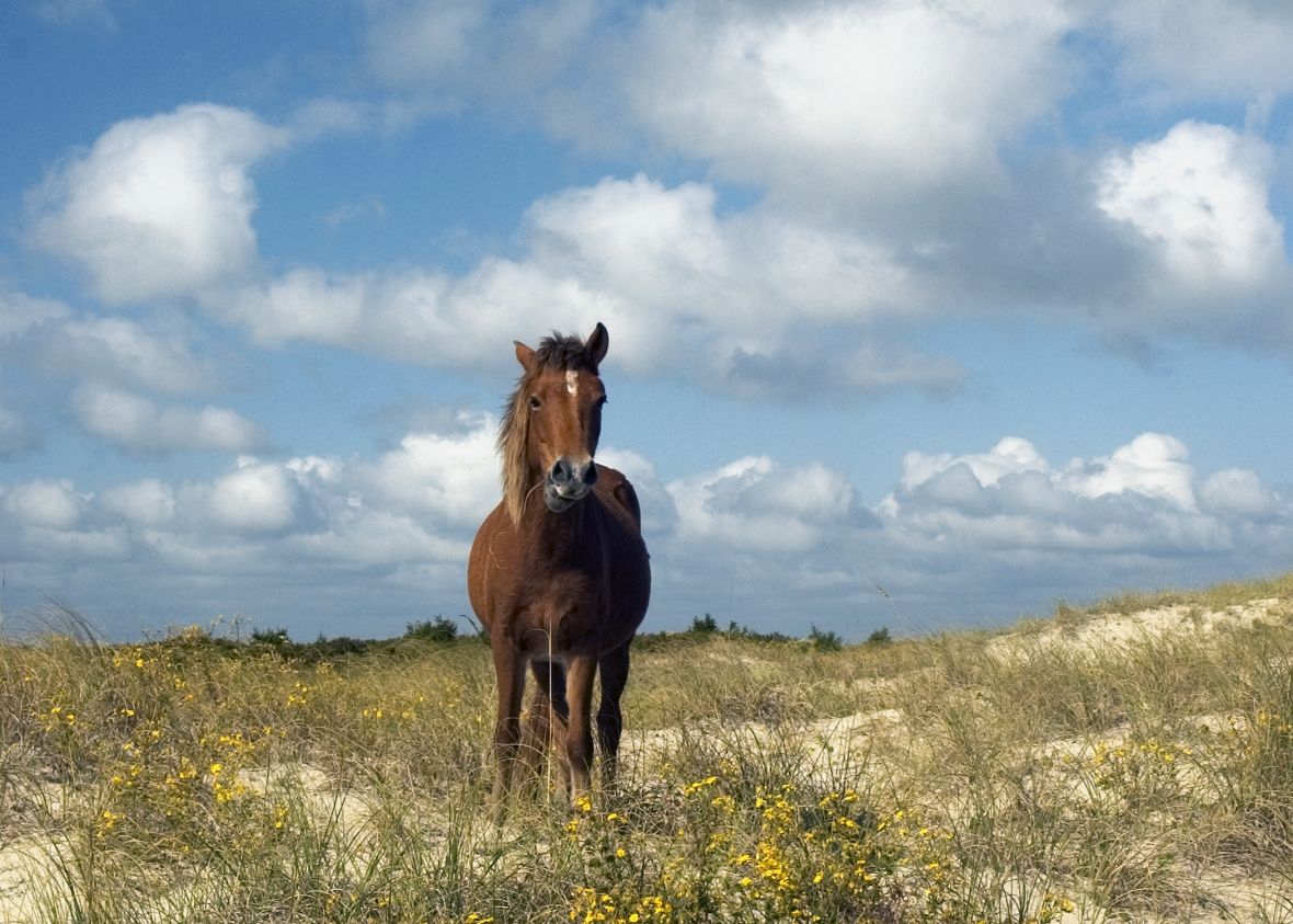
Domestic livestock and wild horses were not removed from Core Banks and Shackleford Banks until the 1950s, when, bowing to the march of progress, the North Carolina General Assembly ordered their removal. Swayed by emotional pleas from a group of Harkers Island residents, Tar Heel legislators allowed an exception for the wild horses of Shackleford Banks. (An exception was also granted on Ocracoke Island, where the nation’s only troop of mounted Boy Scouts captured, tamed, and rode wild Banker horses.) The Shackleford horses are revered in Carteret County today, just as they were in the 1950s. And when Hurricane Isabel was wheeling toward North Carolina, nearly everybody was worried about them.
Isabel was the largest hurricane to hit the North Carolina coast since Floyd had pitched ashore almost exactly four years earlier, on September 16, 1999. Floyd was also a strong category two, and coastal-plain residents remember it well. That storm cost at least $6 billion in damages and killed 52 people in eastern North Carolina alone.
Isabel had the potential to release wave and wind energy of similar proportions. Predictions called for sustained winds approaching 105 miles per hour, gusting to 115; a storm surge of seven to 11 feet above normal tide levels; isolated tornadoes; and total rainfall of six to 10 inches. Two days before Isabel’s anticipated landfall, North Carolina officials ordered 921 Ocracoke Island residents to the mainland. Farther north in Norfolk, Virginia, the navy sailed 40 of its ships out to sea for protection. The air force flew 170 aircraft inland, retreating from coastal bases. States of emergency were announced from North Carolina to Pennsylvania. Amtrak canceled rail service south of Washington, D.C. Air-traffic controllers grounded 5,700 flights at 20 East Coast airports. For the first time due to the threat of a hurricane, government offices were closed in the nation’s capital.
Hurricane Isabel made landfall near Drum Inlet at 1:00 P.M. on Thursday, September 18, 2003. Although sustained winds and tidal storm surge were less than predicted, the storm’s overall impact was enormous. Officials estimated the destruction in seven states at $3.37 billion. Fifty-one people died. In North Carolina, property damage totaled $55 million, and three people drowned. President George W. Bush declared North Carolina and Virginia disaster areas.
The North Carolina coast was punished severely and altered geographically. Just off the Outer Banks at 2:11 P.M. on September 18, the army’s Coastal Hydraulics Laboratory detected the largest wave in the lab’s 27-year history. Cresting at 39.7 feet, it was one of several colossal waves between 36 and 40 feet timed in less than an hour by one of the lab’s wave-rider buoys two miles offshore. On Hatteras Island, the storm tore open a gash nearly 500 feet wide with three channels, creating the first new inlet between Pamlico Sound and the Atlantic Ocean in 40 years.
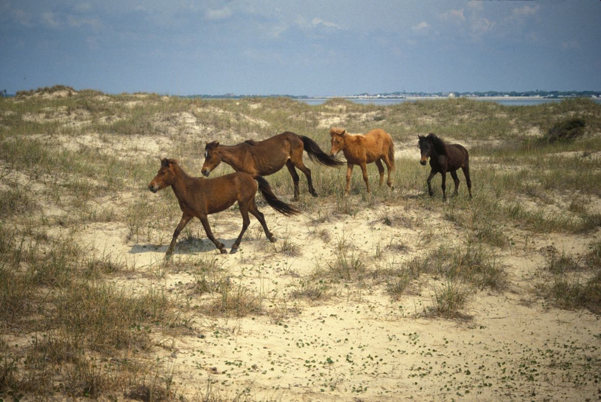
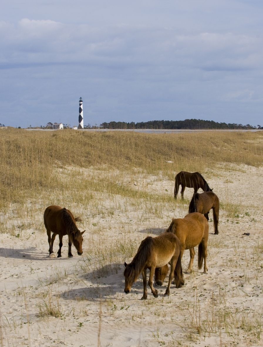
Shackleford Banks is the southern terminus of Cape Lookout National Seashore, a rare 56-mile sweep of undeveloped Atlantic shoreline. Unlike Portsmouth Island and Core Banks, which make up the rest of the seashore and have a generally north-south orientation, Shackleford runs roughly east-west. This means that the island, which is nine miles long and averages a half-mile in width, is exposed to the region’s prevailing southwest winds. Over the millennia, these winds have helped maintain the island’s primary and secondary dunes. Some of the dunes are 35 feet high and provide the natural barrier necessary for creating a maritime forest. The salt spray that the winds carry over the dunes shapes the wedge-like crowns of the live oaks of the island’s interior woodlands.
Shackleford’s east-west orientation also gives the island cover from some of the most destructive hurricane winds, at least those powered by storms steering a northwest course. Since hurricanes in the Northern Hemisphere rotate counter-clockwise, it is Core Banks in Carteret County that takes northeast assaults broadside. Shackleford is more securely positioned, behind the natural breastwork of Core Banks and Cape Lookout.
These conditions, the island’s relatively high ground, and its maritime forest made it suitable for year-round human habitation. In the 19th century, the island was home to several fishing and whaling communities, including the fabled Diamond City, which had about 500 residents. Although those Bankers harvested their livelihoods primarily from the sea and sounds, they also grew peach and fig trees in the lee of the high dunes and woodlands. Adjacent to their homes, they cultivated small gardens. Those gardens and the Bankers’ cottages were enclosed by fences to keep out foraging livestock and wild horses.
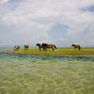
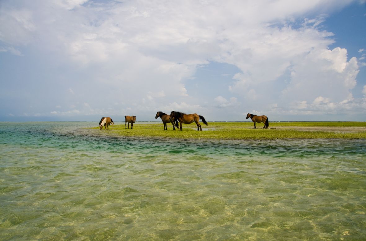
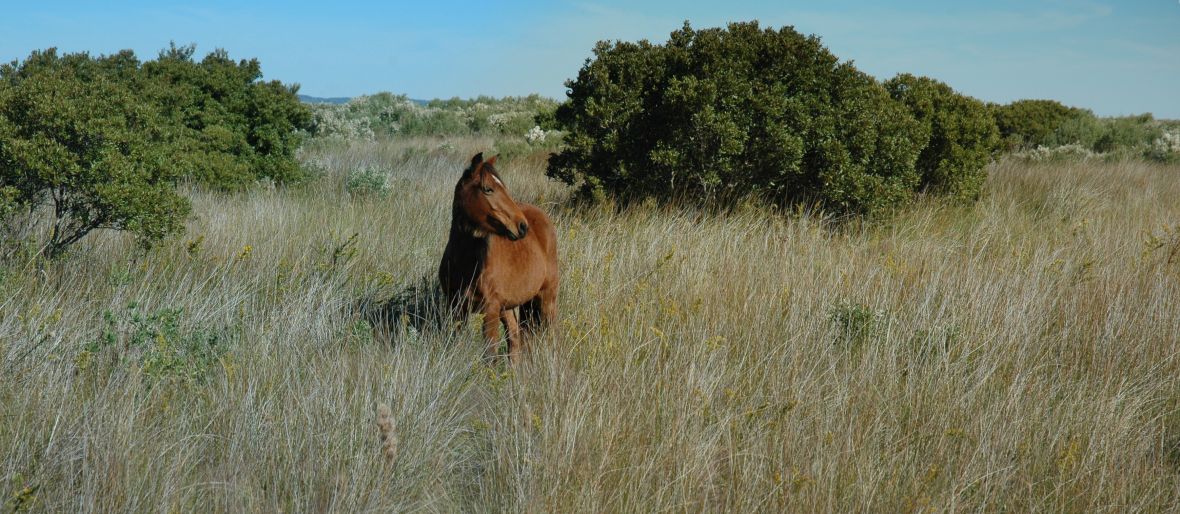
There is no record of how many horses lived on Shackleford in the 19th century. Until the hurricane of 1933, the island was connected to Core Banks. It is known that thousands of horses roamed the entire length of the Outer Banks from Beaufort Inlet north to the Chesapeake Bay until well into the 20th century. On Shackleford, the topography that at one time made the island suitable for human habitation also made it ideal for horses. Thanks to its high ground and protection from gale winds, Shackleford offered an abundance of Spartina alterniflora (a dune grass) and sea oats for grazing. Freshwater pools were on the surface or were accessible by digging a foot or two below the sand. The dense maritime forest on the sound side of Shackleford provided live oaks and cedars for whaleboat frames and planking. Tightly woven thickets of myrtle and cedar also covered the sound-side portions of the island. Many generations of Shackleford horses have learned to use the maritime forest and thickets to their great advantage, especially for riding out storms.
Today, Shackleford’s woodland stretches intermittently over about 3.3 miles of the midwest portion of the island and runs one mile north and south at its widest point. John Alexander and James Lazell describe this relict of ancient maritime forest as “both an island and an anchor in the ecology of the Outer Banks.” Less than 2,000 years old, Shackleford’s forest is the youngest of three important maritime forests on the Outer Banks. (The other two are Buxton Woods on Hatteras Island and, farther north, Nags Head Woods on Bodie Island.) Records indicate that 200 years ago, Shackleford’s loblolly pines and live oaks shaded the island all the way to Cape Lookout. While some of the forest was lost as a consequence of livestock—particularly goats and sheep—grazing at its outer edge, much more vegetation succumbed to storms and the harvesting of the woodland’s timber for home and boat construction. The removal of salt-tolerant live oak trees resulted in the loss of the thick canopy that protected salt-sensitive species of trees and bushes.
The forest has rebounded in the two decades since Shackleford’s livestock was removed in 1985. Horses tend to consume other forms of vegetation. Cavernous and impenetrable except for a meandering network of horse trails, some just waist-high, the forest is a hinterland of almost gothic serenity.
In the aftermath of Hurricane Isabel, Down East residents were relieved that the worst predictions had not come to pass, but no one knew the fate of Shackleford’s 124 horses. That responsibility fell upon the two organizations charged by federal mandate with implementing horse management on Shackleford—the National Park Service and the Foundation for Shackleford Horses, Inc. For several days following the storm, foundation directors Susan Willis, Rose Griffin, and Carolyn Mason and Park Ranger Sue Stuska scoured the island counting noses and checking off names from printed horse-population lists. They were resolved to locate—or account for—the entire herd. The bodies of five horses that washed upon Harkers Island were identified as natives of the Rachel Carson Estuarine Reserve near Beaufort. They were not from Shackleford. In the absence of additional reports of dead horses, there was reason to be guardedly optimistic. The best anyone hoped for was that all of Shackleford’s horses would somehow have survived the storm. No one expected to see more horses on the island than the 124 that lived there before Hurricane Isabel. But nature on the Outer Banks writes her own script, and that’s precisely what happened. Three horses in good condition—a colt, Sugarfoot, and two adult mares, Joanne and Zap—were swept from the Rachel Carson Estuarine Reserve. Unlike their five less-fortunate companions that drowned in Isabel’s floodwaters, these three were carried one mile across Back Sound until they gained footing somewhere on the northern side of Shackleford. After Hurricane Isabel, Sue Stuska was the first to discover them. “We can’t be sure exactly where they landed,” she recalls. “But I found them on the northwest edge of Shackleford—as close as possible to their home.” Since these three castaways were not members of the Shackleford herd, whose identities and numbers are meticulously controlled, they were tested for (and cleared of) diseases in early October, then tranquilized, loaded on boats, and returned to their original island range on the preserve.
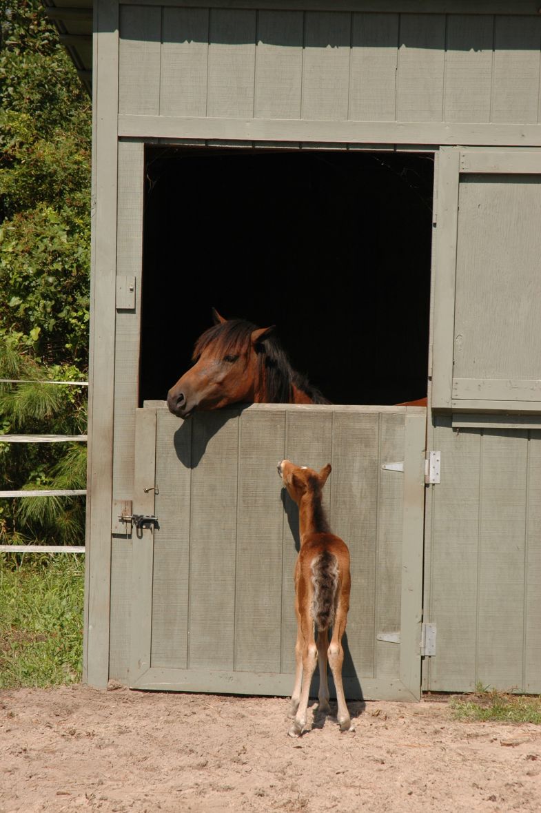
However, there was also a fourth new horse on Shackleford—a filly not more than 48 hours old when she was first sighted on September 22, 2003. Although she was not counted among the 124 residents of the island before the storm, she was very much a member of the island’s horse family, clinging to her mother, a nine-year-old Shackleford mare named Marilyn. No one in the park service or the foundation knew that Marilyn was pregnant, and September is late for horses to give birth. Nor could anyone firmly establish where or when Marilyn had gone into labor, though it was probably about two days after Isabel’s storm clouds and winds barreled off to the northeast. But wherever and whenever she had come into the world, Marilyn’s baby needed a name.
For 25 years, Princeton University behavioral ecologist Dan Rubenstein and his students have been studying the horses of Shackleford Banks. To assist them in identifying horses, they use a naming scheme whereby foals receive names beginning with the first letter of their mother’s name. Because this system simplifies efforts to identify horses of the same matrilineage, both the park service and the foundation have adopted it. But since Isabel was the obvious name for Marilyn’s hurricane filly, they had a problem. A quick-thinking volunteer offered the perfect solution. Why not simply call her Miss Isabel and combine the two words? The proposal was unanimously accepted, and the new filly was christened MissIsabel. She came into the world as a surprise. “No one, except Marilyn, expected MissIsabel,” reported the Associated Press. She immediately became a celebrity, an adorable brown-eyed embodiment of the spirit of her ancestors, the wild horses that have lived by the edge of the sea—and beaten the odds—for more than 350 years.
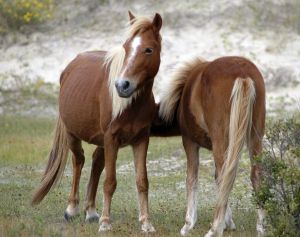
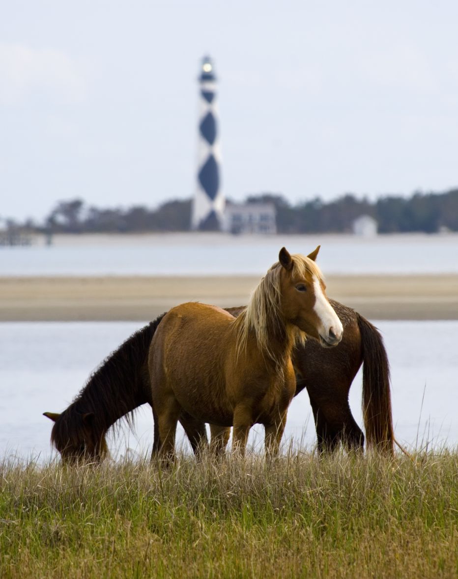
Marilyn and MissIsabel on Shackleford
This material was first published in The Wild Horses of Shackleford Banks by Carmine Prioli and Scott Taylor (2nd edition, Blair, 2024)